Ann Arbor, Michigan
1836 Map
Ann Arbor, Michigan
1836 Map


This 1836 map records lots: All the regular lots are 4 by 8 rods. Lots in block 3 and 4 North, and in the West half of Blocks 3 and 4 South Range, 6 are 8 by 16 rods. Lots in the East half of Block 3 and 4 South are 8 by 14 rods.
Map from the papers of Charles Thayer
Map by N. Currier’s Lithograph, 148 Nassan, corner of Spruce Streets, New York

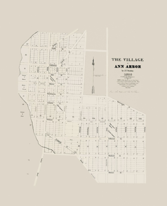

1836


