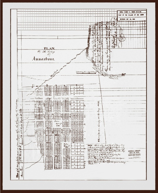
Ann Arbor, Michigan
1824 Plat Map
Ann Arbor, Michigan
1824 Plat Map


John Allen and Elisha Rumsey made their survey May 12, 1824. The plat was recorded on May 24, 1824 as the village of Annarbour. The original plat was made up of 640 acres, Allen bought 480 acres and Rumsey 160 acres. After Allen disposed of a part of his holdings, the area owned by the two men extended from Allen’s Creek to Division Street and from Jefferson to Lawrence. The streets running north to south were named, First (where Rumsey located his house), Second, Third (which later became Main Street), Fourth and Fifth. The east/west streets (beginning to the north of the plat were named North Street, Catherine, Ann, Huron, Washington, Liberty, William and Jefferson.


1836


